Where is the groundwater going?

Springs emerge from a rocky hillside in the Lower Crooked River Canyon: Public domain
Groundwater in Central Oregon is declining
But it should be an infinite resource. What’s really going on?
This year, we’ve heard an increasing number of reports from concerned residents about their wells running dry. Many people who rely on groundwater are finding that they have to bear the costly burden of digging deeper into the ground to access the water on which they rely. While the growing alarm echoes concerns about water use in general, it casts a light on a less familiar water source: groundwater.
Groundwater is the water found deep below the Earth’s surface, stored in rocks and cracks, that makes up a slow-moving underground river called an aquifer. Wherever you are standing in Central Oregon, the volcanic and sedimentary-rock aquifer is likely beneath your feet.
Every year, the aquifer is replenished as snowfall from the Cascade Mountains seeps into the ground. It should be an infinite resource. But is it?
What is happening to Central Oregon’s groundwater?
The geological process of groundwater
Central Oregon is blessed by bountiful groundwater resources. Nearly 42 feet of snow falls each winter in the Cascade Mountains. The mountains’ volcanic rock is highly permeable, and the spring snowmelt seeps into the ground. (Contrary to a common belief in Central Oregon, there is very little snowmelt runoff directly into rivers and streams. Virtually all of the water drains into the aquifer.)
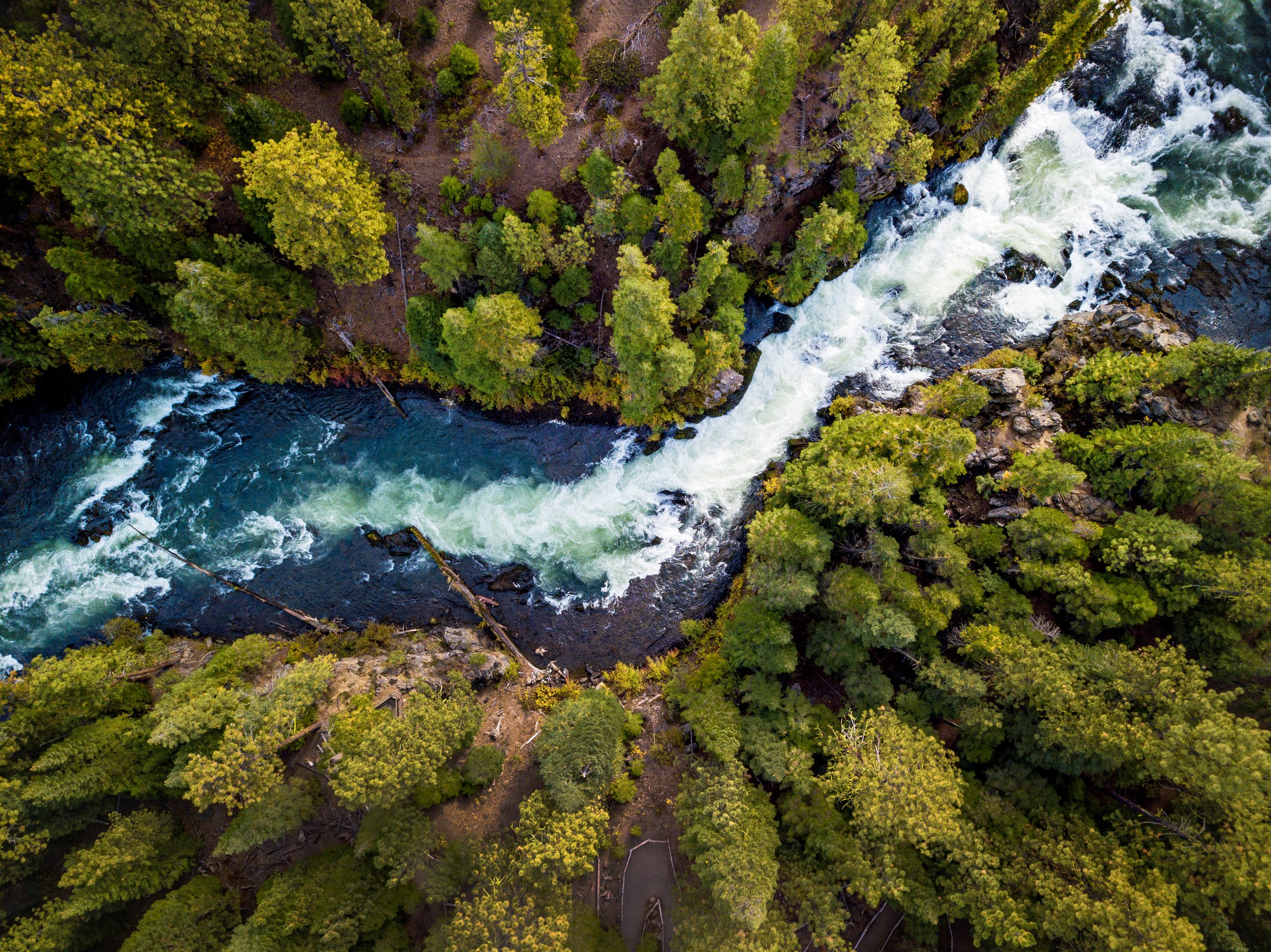
The water sinks through this top layer of volcanic rock until it hits a more solid rock bed (called low permeable rock) many miles downstream. From there, the water pours out from the earth into the river above Lake Billy Chinook. If you’ve seen the many springs emerge from the ground along the Metolius River, or felt the cold water pockets in the Deschutes, you’ve encountered the groundwater meeting the river.

US Geological Survey data
The annual cycle of snowmelt generates an enormous volume of groundwater each year (approximately 3,500 cfs). It is essentially the same as having another Deschutes River flowing beneath the surface.
The groundwater in our area has always been a renewable resource replenished every year.
So why are water levels declining now?
The current decline
According to the U.S. Geological Survey (USGS), between 1997 and 2008, groundwater levels in the central part of the basin from Sisters to Powell Butte steadily declined by as much as 14 feet.
USGS determined that the three main causes of groundwater decline are:
Climate
Groundwater pumping
Irrigation canal piping
Climate is the dominant influence, accounting for 60-70% of the groundwater declines, while groundwater pumping accounts for 20-30% percent of the decline, and canal piping 10%.
Even though these metrics date back to 2008, when we consider the grip that drought continues to have on our region, it is fair to assume that the relative influence of these factors is the same or greater today.
The impact on well water supply
Private domestic wells are affected by the same three factors analyzed by USGS, resulting in a lower water table that often leaves residents with dry wells, lest they dig deeper to access water further underground.
However, the USGS analysis looked at the entire basin, and determining the exact nature of declining water in a particular domestic well is more difficult.
The depth and location of the well also affect its water availability. Generally, a drier climate is lowering the water table, and that factor continues to be a dominant cause of dry wells. But, if a relatively shallow domestic well is close to an area of groundwater pumping or piped irrigation canal, these factors could exacerbate the declines caused by drought and cause an even bigger decline in the well water levels.
Is the aquifer going dry?
In certain areas, there is a cause for concern. For example, we are seeing groundwater declines in the central part of the basin around Redmond.

Springs emerge from the ground forming the headwaters of the Fall River.
In most areas, the simple answer is no. The aquifer is large and water is still recharged every year by the precipitation in the Cascades. While we’ll see variations in the amount of annual precipitation in the mountains, the current long-range climate forecasts do not predict significant declines in mountain precipitation. However, the models do predict that the mountains will receive less snow and more rain, a trend that we already appear to be experiencing.
In short, the aquifer isn’t going dry, but the water may be becoming deeper and more inaccessible.
The impact on Central Oregon
We know the rapidly growing population in Central Oregon will increase groundwater use. We know that increased pumping from cities, destination resorts, and rural developments will reduce groundwater. As groundwater is depleted and the water table moves further beneath the surface, there are fewer coldwater springs and seeps that will flow into our rivers and streams. The water flowing through the Deschutes River below Lake Billy Chinook will decrease unless groundwater use is mitigated.
With foresight into declining groundwater, Oregon passed legislation in 2005 to establish a groundwater mitigation program for this purpose. The policy was meant to require entities that use groundwater (destination resorts, cities, etc.) to replace the water that would be withheld from nearby rivers.
Although this policy is currently in place, we are concerned about the ability of the state to enforce it and regulate groundwater use properly.
This is precisely the foundation for the current hearing surrounding Thornburgh Resort, a proposed destination resort, and their groundwater mitigation plan. LandWatch has serious concerns about the mitigation plan proposed by the resort’s developers.
This plan offers to replace the water it pumps from wells with water rights from a nearby ranch, but we believe that these water rights may not generate actual water instream to mitigate the groundwater pumping.
At LandWatch, we are committed to restoring rivers and streams across the Deschutes River Basin. With your support, will continue to see these conservation efforts through and push for legal accountability to state and federal water laws.
The Deschutes River: Arian Stevens
Restoring rivers and springs
At LandWatch, we are committed to restoring rivers and streams across the Deschutes River Basin. We will continue seeing these conservation efforts through, pushing for policy reform, regional collaboration, and legal accountability to state and federal water laws. These will take time and a big investment, but it is time to act now. Our farmers and rivers are counting on us.
Stay up to date by subscribing to our email updates and action alerts.