Another triumph over rural sprawl

142 acres of rangeland saved from Rural SprawL
Another win for rural lands after 710 acres were protected in July
Recently, LandWatch prevailed in a community effort to halt yet another instance of development interests seeking to convert agricultural land into rural sprawl.
In January, LandWatch appealed a Jefferson County Board of Commissioners decision to approve a zone change for 142 acres of rangeland for rural residential development adjacent to Crooked River Ranch.
On September 8, Oregon’s Land Use Board of Appeals (LUBA) sided with LandWatch and remanded Jefferson County's decision, which means the development cannot proceed.
These 142 acres of rangeland would have been developed into a 70-lot subdivision, miles away from the nearest city - in other words, sprawl. Dozens of Crooked River Ranch community members voiced their opposition to this proposed development, citing serious concerns over increased community fire danger, stress on rural infrastructure, impacts to water resources, and loss of open space.
For over 36 years, Central Oregon LandWatch has worked tirelessly to ensure critical rural values remain an abiding part of our livable future.
This decision from LUBA is another important win for the preservation of agricultural lands, wildlife, and open space on our rural lands.
The Crooked River Ranch community can breathe a collective sigh of relief.

LandWatch prevails at the Land Use Board of Appeals
LandWatch prevailed at LUBA on three major claims:
First, Jefferson County approved exceptions to Statewide Planning Goals 3 (Agricultural Lands) and 14 (Urbanization) for the requested zone change from rangeland to rural residential. LUBA agreed with LandWatch that the County failed to provide coherent, compelling reasons why the exceptions should be justified.
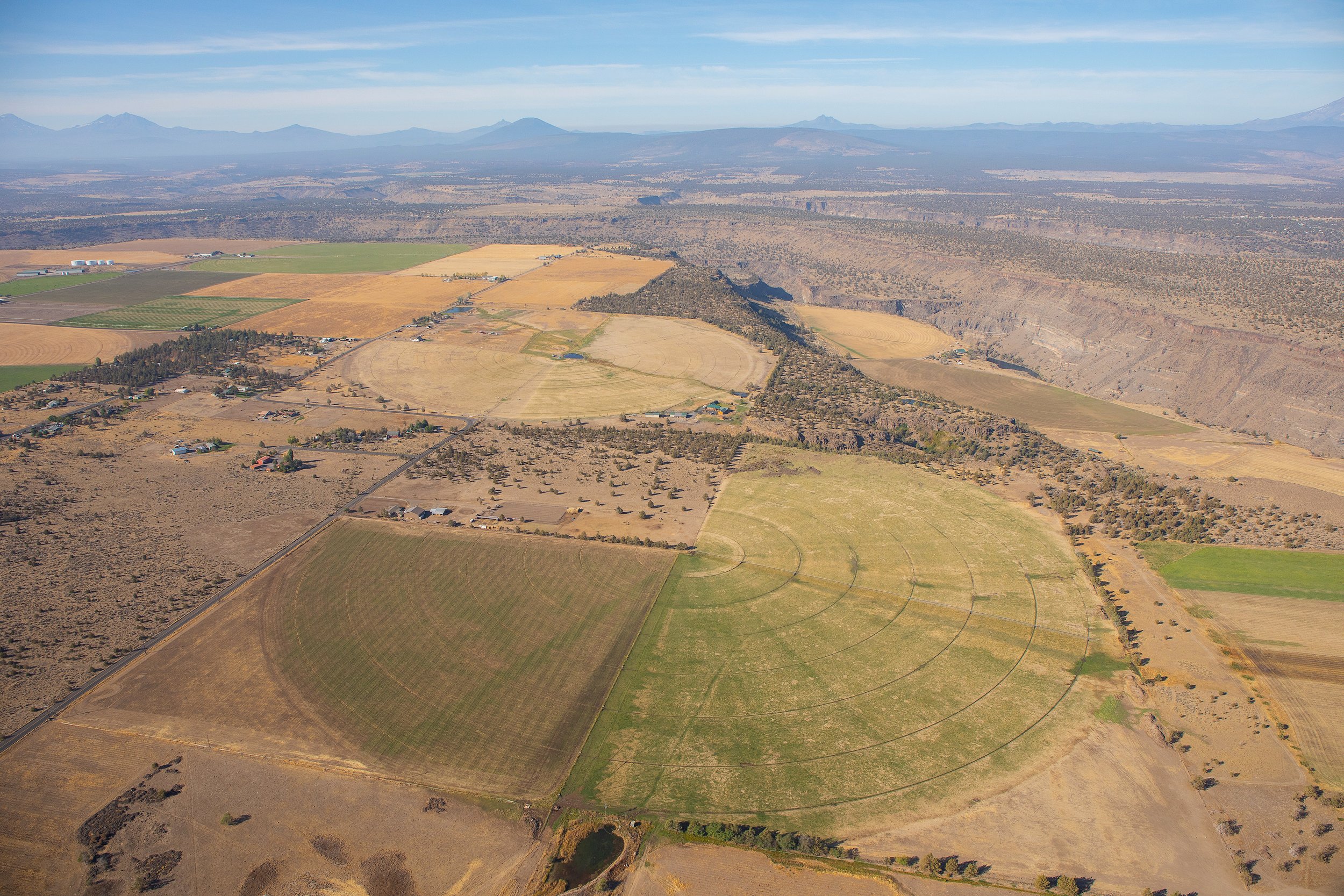
Undeveloped rural land near Crooked River Ranch. 📷: Ryder Redfield
Second, Crooked River Ranch is classified as a rural unincorporated community. As such, it must adhere to a specific set of state land use rules for expansion and rezoning of rural land. In this case, LUBA agreed with LandWatch that the County failed to apply the relevant criteria for expansion of unincorporated communities to the rezoning application.
Finally, this zone change would have amended Jefferson County’s Comprehensive Plan (JCCP) map. The JCCP includes policy that allows plan amendments only when “necessary” or “required.” Given the fact there are numerous existing vacant lots within the Crooked River Ranch unincorporated community that people can buy and build on, as well as many vacant residential lots elsewhere in the area, LandWatch argued that it cannot be deemed “necessary” or “required” to amend the JCCP to rezone this agricultural land for development. LUBA agreed.

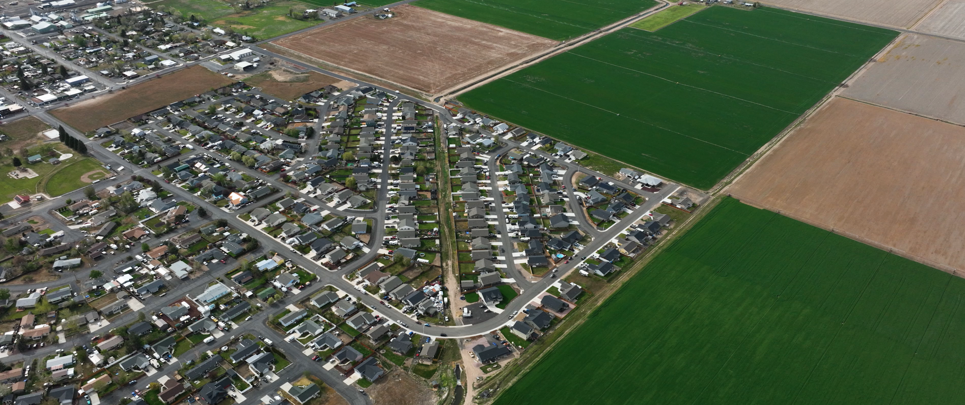
710 acres of agricultural land in Lower Bridge Valley that were protected from rural sprawl by another LandWatch appeal in July. 📷: Ryder Redfield
Defending farmland across Central Oregon
Map view of the 710-acre area. Map courtesy of Deschutes County
Across the region, irreplaceable expanses of agricultural land are routinely subjected to mounting pressure from development interests.
At the end of July, LUBA ruled in favor of LandWatch’s appeal of Deschutes County’s controversial decision to approve the conversion of 710 acres of agricultural land in the Lower Bridge Valley for the development of 71 new luxury homes – mere miles from the proposed 142-acre subdivision near Crooked River Ranch.
In this case, LUBA found that the Board of County Commissioners’ decision to approve the zone change from exclusive farm use (EFU) property for rural residential development was inconsistent with state law.
Ryder Redfield has lived just a half-mile from the proposed development in Lower Bridge Valley for years and offered his thoughts on the importance of defending our rural lands:
“I am about as intimate with the Lower Bridge Valley as possible. When I was a child, I loved driving through the countryside with my father and looking at the cows and fields. I know many people who drive this road just to get a breath of fresh air and to remember what Central Oregon used to look like. I have no doubt that without stricter regulation, Lower Bridge will look exactly like the Old Bend-Redmond Highway does now.”

Lower Bridge Valley. 📷: Ryder Redfield
Conrad Crawford, a farm manager in the Lower Bridge Valley, shared his perspective on the stress to rural infrastructure that would have only increased if the proposed new subdivision was not stopped and brought additional traffic to the area:

Lower Bridge Valley. 📷: Ryder Redfield
“The vehicle traffic has increased so much that we have a hard time moving farm equipment up and down the road in between fields. We just got done moving a driveway at our hay barns to get it farther away from a corner on Lower Bridge Way, because we have almost been hit multiple times. I have had a number of vehicles go through fences up and down Lower Bridge.”
Deschutes County is a leader in the state for approving applications to rezone agricultural land. And as farmland across the country hits record-high prices, it is more important than ever to defend agricultural land, including rangeland, so working farmers and ranchers are not priced out by the artificially increased value of rural land based on speculative development.
Oregon’s Urban Growth Boundaries are a useful tool for protecting farms and forests from urban sprawl and promoting Complete Communities connected to existing public facilities and services inside the boundary.
Guiding responsible growth
It’s no secret that our Central Oregon communities are growing – and with that comes a need for housing. However, using undeveloped rural lands that are disconnected from infrastructure and distant from jobs and services for sprawling subdivisions is not a responsible approach for accommodating growth and creating Complete Communities.
Oregon’s Land Use Planning laws are designed to protect farmland for farm use and direct growth inside urban growth boundaries. By strictly limiting housing on agricultural land , these laws are intended to keep prices low enough for farmers to buy land or expand their operations. And by responsibly directing growth within our cities and towns, we can build sustainable, complete communities that don’t contribute to sprawl and climate change.

A community-supported organization
Whether we’re defending our region’s rural lands or saving large, old trees from the chopping block across 7 million acres of forestland, LandWatch works day in and day out to create a sustainable and equitable future for Central Oregon.
As the environmental watchdog for all of Central Oregon, we’ve got a lot of territory to cover. We’re grateful to be supported by an amazing community of passionate advocates who believe in our mission to create well-planned cities and protect wild, open spaces across the region. Together, we’ll continue to define a path that sustains our extraordinary ecosystems, meets the needs of our diverse and growing communities, and affords everyone the chance to experience this special part of the world for generations to come.
Please consider supporting LandWatch now and in the future. You can learn more and explore options on our Membership page.