
One Key Move Solves Many Water Challenges
Reduce the unnecessary use and there’s enough water to restore rivers and serve farms
This summer, we’ve provided an in-depth look at the causes and consequences of water waste in the Deschutes Basin.
A water rights system established more than a century ago has created an increasingly untenable situation for Central Oregon's working farms and fish and wildlife. It’s a problem that cannot go on another summer.
At the crux are senior irrigation districts that are delivering too much water, often to non-productive lands, while losing lots of water along the way due to outdated district policies and practices, and highly inefficient technology and infrastructure.
Significant change is overdue and declining precipitation and increasing temperatures have made the challenges even greater. We cannot easily affect the climate, but we can tackle a key man-made problem – the vast inequitable distribution of water in our basin.
In the final piece of this series, we focus on one key move that could be achieved through legislative or administrative action to address wasteful water use practices and inequitable distribution in the Deschutes Basin. The amount of water that could be saved by this one move alone is astonishing.
Address the Mismatch: Stop Sending More Water than Crops Need
On average, Central Oregon Irrigation District (COID)—the largest senior water right holder in the Basin—diverts three and a half times the water needed by crops in the district. (1)
While some of that water is lost to canal seepage as it travels from the river to district patron’s properties, COID’s target on-farm water delivery is still roughly 4.5 acre-feet per acre. (2,3)
Grass hay, which is one of the thirstiest crops grown in the Central Oregon irrigation district, needs around 3 acre-feet per acre of water during the growing season.
The difference between those two amounts is "unnecessary use,” in water policy language, and one of the three types of water waste we have described in this series.
Downshifting to delivering 3-acre-feet of water across the 42,000+ acres of irrigated lands within COID(4) could reduce this unnecessary use of water by more than 70,000 acre-feet. That's roughly 23 billion gallons of water, or enough water to serve more than double the current number of households in Deschutes, Jefferson, and Crook counties for a year.(5)
The grass hay still gets the water needed to grow, and that 70,000 acre-feet of water saved can help meet important water needs elsewhere in the Basin.
(Note that while COID is used as an example, this scenario could apply to all senior irrigation districts in the Deschutes Basin.)
What That Water Savings Can Do:
Restore flows in the Crooked and Deschutes Rivers AND Give Reliability to Jefferson County Farmers
There are two good reasons to conserve this water instead of wasting it.
The first is to restore instream flows in the stream reaches that are falling short of objectives set by the Oregon Department of Fish and Wildlife, and where low flows and high water temperatures threaten the ecological integrity of our rivers.
The second is to improve the reliability and availability of water for productive, working family farms in North Unit Irrigation District (NUID) in Jefferson County. The farmers in Jefferson County hold junior water rights and consistently receive less water than their peers in other Basin irrigation districts, despite needing that water to stay in business farming.
The greatest unmet water needs in the Deschutes Basin are in our rivers and the productive family farms in Jefferson County.
So, let’s look at what 70,000 acre-feet of water could accomplish.
Recharging the Crooked River
The Crooked River is one of the most significant geographies for steelhead and salmon in the Deschutes Basin. However, over the past century dams, irrigation activities, and other human activities have significantly degraded the river system. After decades of restoration efforts by Indigenous tribes and other Basin interests, low flows continue to strand fish and create lethally hot conditions for steelhead.
The steelhead, Chinook salmon, and resident redband trout in the Lower Crooked River need 140 cubic feet of water per second (“cfs”) to meet their needs, according to ODFW.(6)
Yet during the irrigation season, the Bureau of Reclamation is only legally required to release 10 cubic feet per second from Bowman Dam for the benefit of fish and wildlife.
Currently, North Unit Irrigation District pumps roughly 14,000 acre-feet of water annually out of the Crooked River canyon and into its canal system; a tremendously expensive way to get some of the water they need. (7) While there are many other irrigation demands on the Crooked River, North Unit’s use of water from both the Deschutes and Crooked River opens up an opportunity to help restore Crooked River stream flows and support Jefferson County farms.
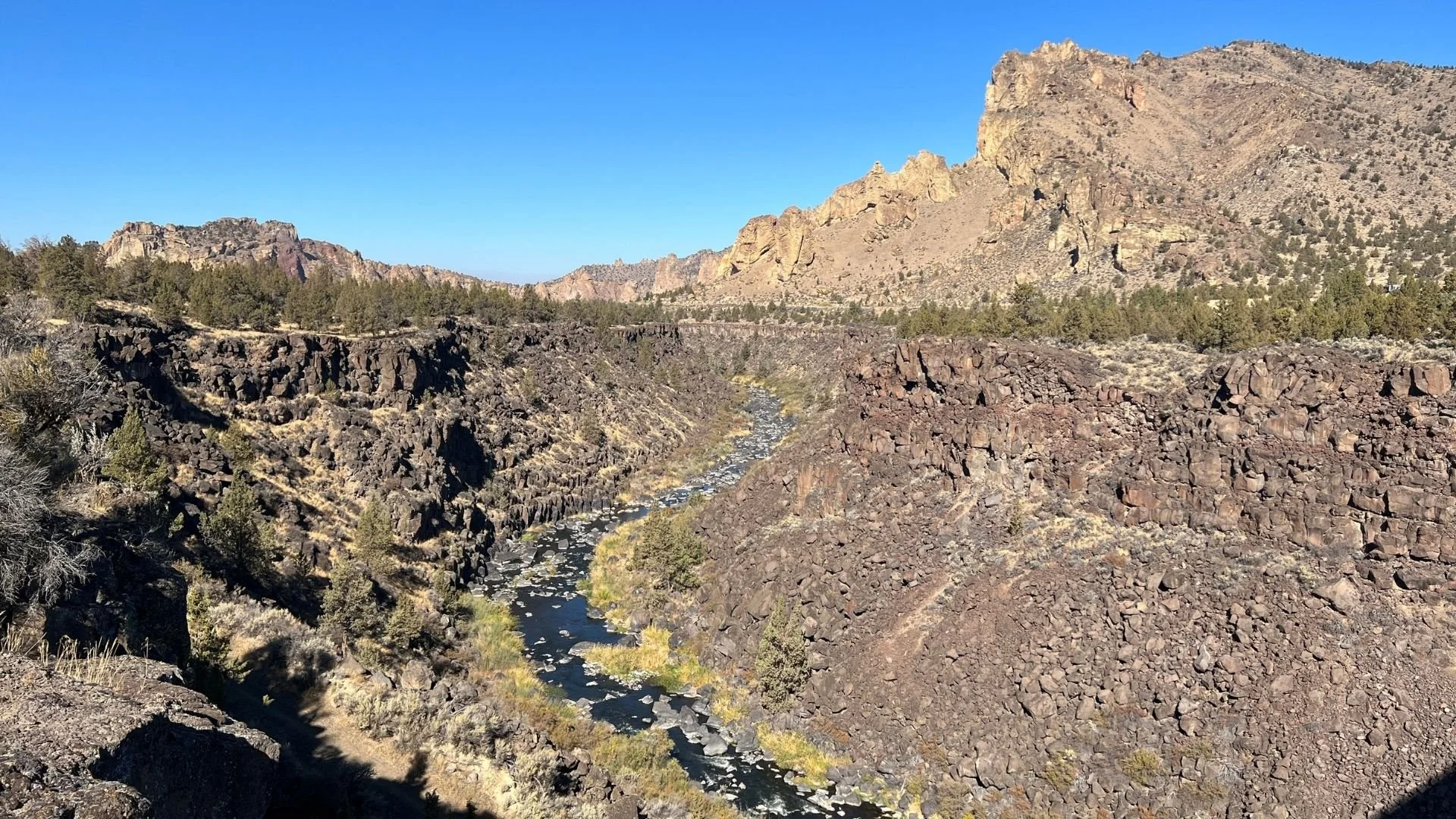
The Crooked River near Smith Rock
The possibility here: Central Oregon Irrigation District transfers ~14,000 acre-feet of the water it doesn’t need to the North Unit Irrigation District. In exchange, North Unit transfers a commensurate amount of water instream in the Crooked River.
This would restore ~38 cfs to the Crooked River, from just upstream of Smith Rock State Park to Lake Billy Chinook, during the irrigation season, and provide North Unit with additional senior-priority Deschutes Water without the cost of pumping.
This wouldn’t solve all the ecological challenges on the Crooked River, or all of North Unit’s water availability concerns. But it would be meaningful progress for culturally-important fish species and an important step forward to support productive agriculture in Jefferson County.
Restoring the Middle Deschutes
In the stretch of the Deschutes River from Bend to Lake Billy Chinook, often called the Middle Deschutes, it wasn’t uncommon just a few decades ago for the river to go completely dry during summer months. Today, while restoration efforts have made important gains, nearly 95% of the river’s water is diverted at the north end of Bend, leaving only a minimal amount of water instream.
An instream flow of 250 cfs is the bare minimum needed to keep native wildlife species at self-sustaining levels.(8)
That amount of water allows fish to migrate, spawn, and raise their young.
In 1990, ODFW filed for an instream water right for year-round flows of 250 cfs, but it hasn’t received it. Currently, summer flows in the Middle Deschutes top out around 150 cfs.(9)
The possibility here: Transferring 28,000 acre-feet from Central Oregon Irrigation District to the Middle Deschutes during irrigation season would make significant progress on closing the 100 cfs instream flow gap.
While reaching year-round flows of more than 200 cfs does not solve all the ecological challenges in the Middle Deschutes, it would go a long way in a reach of the Deschutes River long plagued by low summer flows.
If you’re following along on the math, we’ve reapplied 42,000 acre-feet so far, and still have 28,000 acre-feet left to better use.
Upping winter flows in the Upper Deschutes
Over a century of human-caused degradation has left the Upper Deschutes River in dire need of both stream flow and riverbank restoration. It’s running at ~100 cfs in the winter now, but historically would have run year-round at or above 600 cfs.
Under the Deschutes Basin Habitat Conservation Plan (HCP), NUID will be required to release 300 cfs of water from Wickiup Reservoir during the winter starting in 2028, an important step in restoring the Upper Deschutes River.(10)
To meet these flow restoration measures irrigation districts have focused nearly exclusively on modernizing their infrastructure, with the hope that canal piping will conserve 200 cfs of streamflow that can be passed to NUID to help achieve the near-term winter release requirements.
However, at present, piping has conserved less than 50 cfs of water to help meet the HCP winter flow requirement.
With just two years until the 300 cfs winter flow requirement kicks in, it’s still not clear when COID and other senior districts expect to complete planned piping projects. If piping projects don’t save enough water to meet the HCP conservation measures, the balance of needed water will come directly out of NUID’s water supply. This means the most productive farmers in the Basin, who have the least access to water under the current system, will take the hit.

Deschutes Canyon. Photo: Ryder Redfield
The possibility here: Transfer 28,000 acre-feet from COID, roughly 94 cfs of water, into the Upper Deschutes during the winter months to help Jefferson County farmers meet the 300 cfs winter flow requirement under the HCP. Like conserved water from piping projects, this water could be passed to NUID in the summer in exchange for a commensurate amount of water being permanently protected instream during the winter.
Combined with the water savings from proposed piping efforts, this redistribution of unnecessary water waste within COID would help restore more stable flows in this critically important waterway while also supporting Jefferson County farming.
And that brings our water savings balance from this scenario to reduce unnecessary water use to zero. We’ve done a lot of good for fish and farms with those 70,000 acre-feet while still delivering enough water for COID to grow even the thirstiest of crops. And remember, this move is just one of the potential opportunities to conserve water in the Deschutes River Basin.
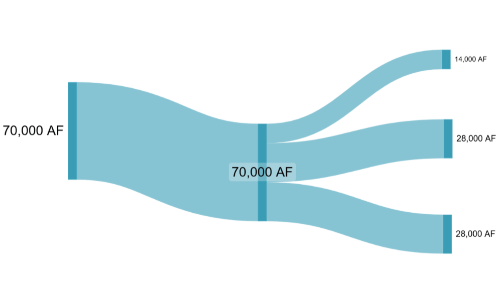
Where 23 billion gallons (aka 70,000 acre-feet of water) could go.
What It Will Take To Get There
The Deschutes Basin needs an integrated water strategy that addresses wasteful water use practices within irrigation districts. This strategy needs to include infrastructure modernization, plus water sharing programs and strategic legislative and administrative actions to address water waste.
How those legislative or administrative actions are structured could vary greatly, but one point remains clear – we will not solve the water challenges facing Central Oregon without a strategy that includes tackling water waste in our basin.
(1) COID 2021. COID Patron Handbook (See tables 2-5, 2-6, and 2-9; COID’s average annual diversion between 2015-202 0 was 292,509 acre-feet, while the average annual irrigation requirement was 79,897 acre-feet).
(2) COID 2022. Water Management and Conservation Plan. (See Table 2-9, Crops Commonly Grown, Average Monthly Consumptive Use, and Annual Irrigation Requirement Estimated from Agrimet Station BEWO and POBO from 2015 to 2020).
(3) COID 2021. COID Patron Handbook (See page 22, “At the present, the District is delivering six gallons per minute per acre of water right.”)
(4) Central Oregon Irrigation District. 2022. Water Management and Conservation Plan.
(5) https://www.bendsource.com/news/water-at-home-17557405/ (last accessed August, 2026); https://www.census.gov/quickfacts/fact/table/deschutescountyoregon/PST045225 (last accessed August. 2026)
(6) Hardin, Tim. 2011. Modeling flow alternatives to balance fish, reservoir, and out-of-stream needs in the Crooked River below Prineville Reservoir. Oregon Department of Fish and Wildlife. Salem, Oregon.
(7) From 2012 through 2017 the NUID Crooked River pumps diverted an average of 13,796 AF per year out of the river. (HCP at 3-27)
(8) Water right Application IS 70695, Proposed Final Order (See ODFW’s April 5, 1996 letter)
(9) OWRD Near Real Time Hydrographics Data – station 14070500. (Last accessed July 2026) (During the 2025 irrigation season, during the months of April and May the Middle Deschutes fluctuated between 73-90 cfs, and between 135-149 cfs in May – September. Across the entire irrigation season the river went above 150 cfs for just 1 day).
(10) Starting in 2034, the minimum winter flow requirement will increase to 400 cfs; however, the U.S. Fish and Wildlife has identified the need for up to 600 cfs of flows outside the irrigation season, especially during the spring months, to support habitat conditions during critical frog breeding periods.